Skip to content
CMD.EXE
C:\FIELD\MANOLO> event-monitor --live
MOVEX:0000 Y:0000LIVE
> SYSTEM input monitor ready> STATUS waiting for events> --:--:-- IDLE awaiting signal> --:--:-- IDLE awaiting signal
C:\FIELD\MANOLO>
FIELD.OS / PERSONAL ARCHIVE

MANOLOREYGARCIA

ENVIRONMENTAL ENGINEER
FULL-STACK SYSTEM BUILDER

Building digital systems where territory, data, interfaces and code converge.

Quick viewShort on time? All in 2 minutes
SCROLL TO
EXPLORE

△   PROFILE STILL EVOLVING

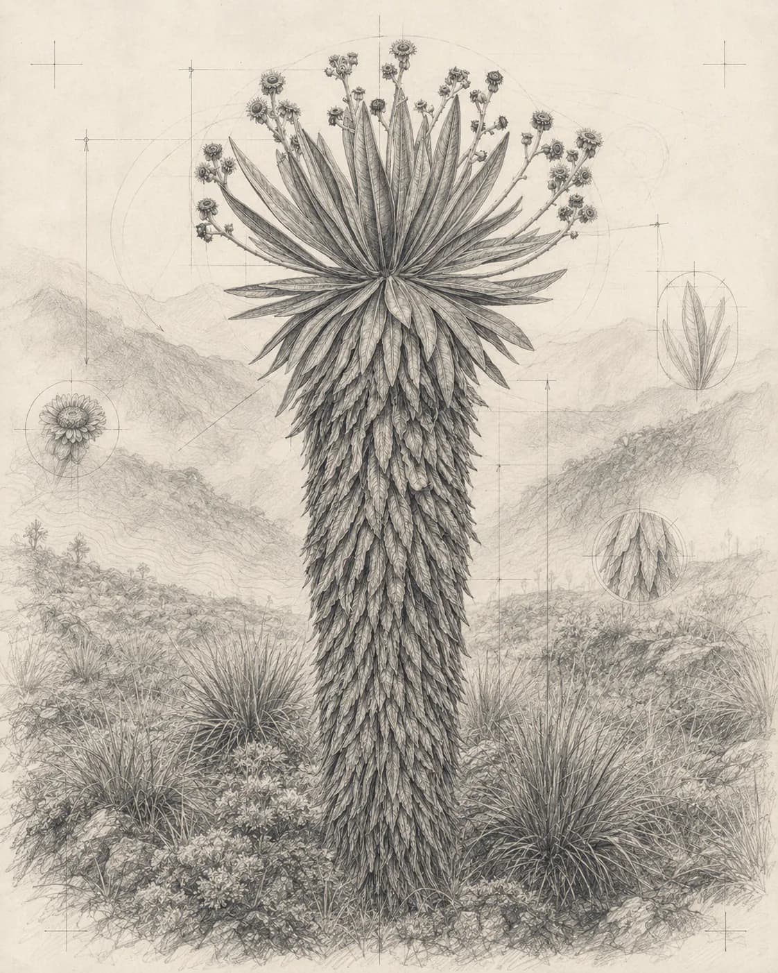
SPECIMEN.VIEW01 / 06
Espeletia uribei in an Andean páramo landscape
ESPELETIA URIBEIFRAILEJÓN / ASTERACEAE
ANDES / COLOMBIAEASTERN CORDILLERA
1,900–3,700 M A.S.L.
SPECIES.DATA
ACCEPTED NAME

Espeletia uribei Cuatrec.

FRAILEJÓN · PUBLISHED IN 1953

COL01
CONSERVATIONLCLeast concern
ELEVATION1,900–3,700 mabove sea level
LIFE FORMShrubalso small tree
ENDEMISMColombianative and endemic
CLASSIFICATION
Plantae › Asterales › Asteraceae › Espeletia
RECORDED DISTRIBUTION
Bogotá D.C. · Boyacá · Cundinamarca · Huila · Meta
BIOME / HABITAT
Montane tropical · páramo and Andean highlands
CROSS-CHECKED DATA
POWO / KEW IUCN 2021
CPLC · ACCESSED 2026
ENDEMIC_SPECIES.COLOMBIA01 / 06
06 ARCHIVE RECORDS 01 ACTIVE SPECIMEN
VIEW_MODE
FIELD.OS V1.0.0 SYSTEM ONLINEBOGOTÁ, COL04°42′NNORMAL MODESCROLL TO EXPLORE ↓

ROOTS / IDENTITY

Explore the lettersTouch the letters↓
WORLD.TRACE / PERSONAL COORDINATES

Three places. One evolving point of view.

These routes mark lived experience, not a strict chronology. Bogota remains the current point of departure.
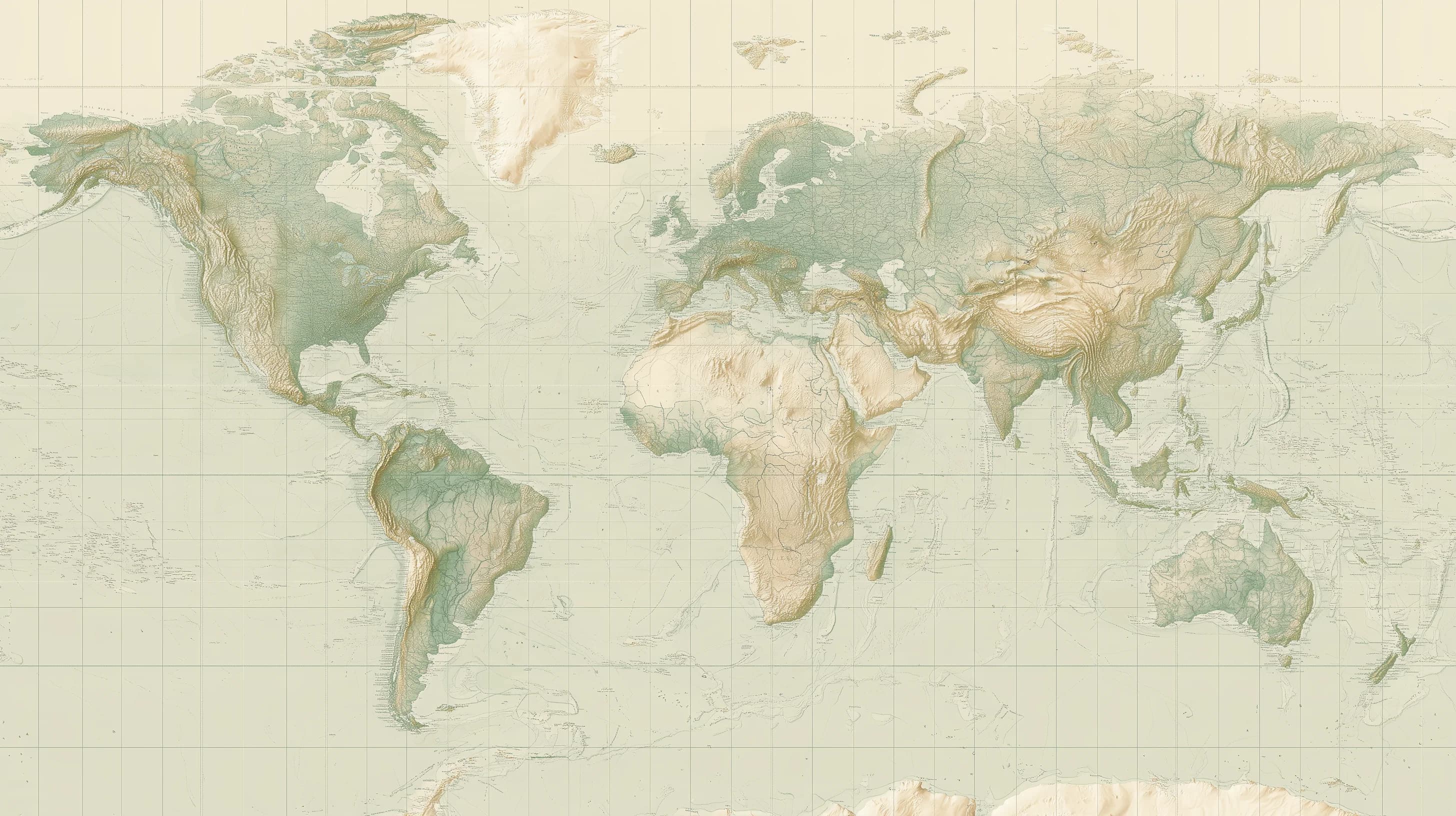
Bogota, Richmond Hill and BilbaoPersonal geography connecting the current base in Bogota with lived experience in Richmond Hill and an undergraduate exchange in Bilbao.
WORLD.TRACE / BIOGRAPHICAL FIELDBOGOTA = CURRENT NODE
03 NODES02 TRACESLIVE
01 / 00
PROGRAM.STACK / 09 DEPLOYED SYSTEMSVIEW ALL PROJECTS

Explore my projects

Navigate a paper world or keep exploring the portfolio.

Program
Stack

A living archive of platforms, maps and tools built to turn complex processes into usable systems. Keep scrolling to traverse it.

SCROLL / EXPLORE →
Fuentes de Financiación cover, NORMAL mode
01 / 09FINISHED · VALIDATED · ACTIVE
Product strategy / UX/UI

Fuentes de
Financiación

A digital experience that turns a complex catalogue into a clear path for discovery, comparison and consultation.

  • Next.js
  • React
  • TypeScript
PIV cover, NORMAL mode
02 / 09FINISHED · VALIDATED
Product design / Full-stack

PIV

A web application for recording, monitoring and analysing investment projects with traceability and physical-financial control.

  • React 19
  • TypeScript
  • Vite 8
PAI cover, NORMAL mode
03 / 09FINISHED · VALIDATED · ACTIVE
Product evolution / Institutional planning

PAI

Evolution from a first planning and monitoring platform to a modular application built with React and TypeScript.

  • JavaScript
  • React 19
  • TypeScript
SIGMA cover, NORMAL mode
04 / 09FINISHED · VALIDATED · ACTIVE
GIS / UX/UI

SIGMA

Geographic indicator monitoring through maps, filters, metrics and reporting flows.

  • HTML5
  • CSS3
  • JavaScript ES Modules
SIO cover, NORMAL mode
05 / 09FINISHED · VALIDATED
Operational monitoring / Staged workflow

SIO

A PWA for managing tasks, progress, evidence, reviews and indicators with traceability.

  • React 19
  • TypeScript 6
  • Vite 8
MIRA cover, NORMAL mode
06 / 09FINISHED · VALIDATED · ACTIVE
Dashboard and status signals / Search and filters

MIRA

Traceable management of corrective and improvement actions through stages, alerts and operational monitoring.

  • React 19
  • TypeScript 5.9
  • Vite 7
Frente Frío cover, NORMAL mode
07 / 09FINISHED · VALIDATED · ACTIVE
Executive dashboard / Activity consultation

Frente Frío

Physical, financial and territorial monitoring with validated reports and map visualisation.

  • HTML
  • CSS
  • JavaScript ES modules
SIG-OXI cover, NORMAL mode
08 / 09FINISHED · VALIDATED · ACTIVE
GIS / Product design

SIG-OXI

A web platform for querying and mapping Tax-for-Works projects with territorial and analytical views.

  • HTML5
  • CSS
  • JavaScript ES Modules
VILA cover, NORMAL mode
09 / 09FINISHED · VALIDATED · ACTIVE
Full-text search / Editorial governance

VILA

A search and governance workflow that turns institutional experiences into discoverable, reusable lessons.

  • React 19
  • TypeScript
  • Vite 8
STACK.END / 09 OF 09Full index

Explore the record and documented process behind every program.

VIEW ALL

ECO.TECH / BRAINSTORM FIELD

ENVIRONMENT × DATA × CODESCROLL / FOLD
TERRITORYCODEBIODIVERSITYDATA
WATERALGORITHMSFORESTSAPIS
CLIMATETYPESCRIPTCARTOGRAPHYDATA
ECOLOGYFRONTENDSENSORSBACKEND
ENERGYCLOUDREGENERATIONSYSTEMS
SOILJAVASCRIPTMONITORINGGIS
WETLANDSINTERFACESANALYTICSSPECIES
RIVERSOPEN DATARESILIENCEMODELS
CONSERVATIONUXTRACEABILITYAUTOMATION
CARBONDATABASESGREEN INFRASTRUCTURENETWORKS
TERRITORYREACTINDICATORSMAPS
BIOMESAPIGOVERNANCEINFORMATION
ALERTSPIPELINESPREVENTIONSCALABILITY
COVERAGESVGPARTICIPATIONPLATFORMS
RESTORATIONDEVOPSWATERSHEDSPROTOTYPES
CIRCULARITYPRODUCTIMPACTCODE
NATURETECHNOLOGYDECISIONSEVIDENCE
SATELLITESGEODATACLIMATE CHANGENODES
COMMUNITIESDESIGNSERVICESTERRITORY
ECOSYSTEMSSOFTWARETRANSPARENCYMETRICS
AIRARCHITECTURESCENARIOSSIGNALS
LANDSCAPEFULL STACKADAPTATIONVISUALISATION
RISKSECURITYFORECASTOPEN DATA
PLANETLOGICFIELDSYSTEM
TERRITORYCODEBIODIVERSITYDATA
WATERALGORITHMSFORESTSAPIS
CLIMATETYPESCRIPTCARTOGRAPHYDATA
ECOLOGYFRONTENDSENSORSBACKEND
ENERGYCLOUDREGENERATIONSYSTEMS
SOILJAVASCRIPTMONITORINGGIS
WETLANDSINTERFACESANALYTICSSPECIES
RIVERSOPEN DATARESILIENCEMODELS
CONSERVATIONUXTRACEABILITYAUTOMATION
CARBONDATABASESGREEN INFRASTRUCTURENETWORKS
TERRITORYREACTINDICATORSMAPS
BIOMESAPIGOVERNANCEINFORMATION
ALERTSPIPELINESPREVENTIONSCALABILITY
COVERAGESVGPARTICIPATIONPLATFORMS
RESTORATIONDEVOPSWATERSHEDSPROTOTYPES
CIRCULARITYPRODUCTIMPACTCODE
NATURETECHNOLOGYDECISIONSEVIDENCE
SATELLITESGEODATACLIMATE CHANGENODES
COMMUNITIESDESIGNSERVICESTERRITORY
ECOSYSTEMSSOFTWARETRANSPARENCYMETRICS
AIRARCHITECTURESCENARIOSSIGNALS
LANDSCAPEFULL STACKADAPTATIONVISUALISATION
RISKSECURITYFORECASTOPEN DATA
PLANETLOGICFIELDSYSTEM
TERRITORYCODEBIODIVERSITYDATA
WATERALGORITHMSFORESTSAPIS
CLIMATETYPESCRIPTCARTOGRAPHYDATA
ECOLOGYFRONTENDSENSORSBACKEND
ENERGYCLOUDREGENERATIONSYSTEMS
SOILJAVASCRIPTMONITORINGGIS
WETLANDSINTERFACESANALYTICSSPECIES
RIVERSOPEN DATARESILIENCEMODELS
CONSERVATIONUXTRACEABILITYAUTOMATION
CARBONDATABASESGREEN INFRASTRUCTURENETWORKS
TERRITORYREACTINDICATORSMAPS
BIOMESAPIGOVERNANCEINFORMATION
ALERTSPIPELINESPREVENTIONSCALABILITY
COVERAGESVGPARTICIPATIONPLATFORMS
RESTORATIONDEVOPSWATERSHEDSPROTOTYPES
CIRCULARITYPRODUCTIMPACTCODE
NATURETECHNOLOGYDECISIONSEVIDENCE
SATELLITESGEODATACLIMATE CHANGENODES
COMMUNITIESDESIGNSERVICESTERRITORY
ECOSYSTEMSSOFTWARETRANSPARENCYMETRICS
AIRARCHITECTURESCENARIOSSIGNALS
LANDSCAPEFULL STACKADAPTATIONVISUALISATION
RISKSECURITYFORECASTOPEN DATA
PLANETLOGICFIELDSYSTEM
METHOD.RUN / REPEATABLE PRACTICE05 / MOVEMENTS

A sequence for turning complex signals into decisions that can operate.

0102030405
FIELD → SIGNAL → SYSTEM
OPERATING.PROTOCOL

From the field to the system.

01 / 05> context --read

Understand the field

Read the territory, the people, the constraints and the real conditions before proposing a response.

FIELD / PEOPLE / LIMITS
02 / 05> signals --trace

Find relationships

Detect signals, repeated failures and the places where information or decisions lose continuity.

SIGNALS / PATTERNS / FRICTION
03 / 05> decision --model

Give form to a direction

Plan, prioritise and turn a complex situation into a sequence of decisions that can be tested.

PLAN / PRIORITY / DESIGN
04 / 05> response --build

Make the response real

Build the intervention, system or product with enough structure to operate beyond the first prototype.

PROTOTYPE / SYSTEM / OPERATION
05 / 05> impact --verify

Learn from operation

Verify how it works, what improved, what remains limited and what the next iteration should resolve.

RESULT / LIMITS / NEXT
CONTEXTOBSERVEDECIDEBUILDIMPACT
0001CONTEXT02OBSERVE03DECIDE04BUILD05IMPACT05
04°42′N / 74°04′WEND.SEQUENCE / 2026
AN IDEA DOES NOT END HERE

OBSERVE.CONNECT.BUILD.

+
FIELD.LOG / READY FOR THE NEXT SIGNAL

The next signal can start here.

I design and build digital systems that connect territory, data and decisions.

EXPLORE SYSTEMSVIEW PROFILE
SCROLL / CLOSE THE LOOP
MANOLO REY GARCIA — SYSTEMS × TERRITORY × TECHNOLOGY —MANOLO REY GARCIA — SYSTEMS × TERRITORY × TECHNOLOGY —MANOLO REY GARCIA — SYSTEMS × TERRITORY × TECHNOLOGY —MANOLO REY GARCIA — SYSTEMS × TERRITORY × TECHNOLOGY —
FIELD.OS / END OF RECORD

Thank you for exploring the system.MY PORTFOLIO.

01SYSTEMS02PROCESS03ABOUT04OVERVIEW05CONTACT↺REPLAY INTRO♪CREDITS
BOGOTÁ, COLOMBIA / 04°42′N© 2026 MANOLO REY GARCIA
X:0000 Y:0000